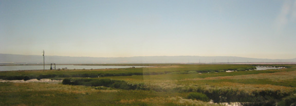
South Bay wetlands viewed from one of
the alignments under consideration for a San Jose - Oakland
high speed rail link by the CHSRA.

|
There are two significant wetlands areas along the alignments
for high speed rail between the Bay Area and the Central Valley line.
One is around the southern end of San Francisco Bay, the other is in
the Central Valley, between Interstate 5 and Route 99, northeast of the
town of Los Banos. There are many smaller areas of wetlands, such as
southeast of Gilroy, but this discussion will focus on the bay.
"the Altamont Pass would not avoid or substantially reduce
potential environmental impacts, since it would require the
construction of a new wetlands/water crossing over San Francisco Bay to
serve the San Francisco Peninsula." But the greater impacts (discussion below) of one of the
remaining alignments between San Jose and Oakland is not discussed in
detail, and an assertion that the HSR line would be "within the
existing (freight) tracks" flys in the face of the need to seperated
the high speed trains from private UPRR frieght trains. From page 2-53 of the DEIR/EIS.... "Mulford Line portion of this alignment would result in
impacts from traversing 4 mi (6 km) of the Don Edwards San Francisco
Bay National Wildlife Refuge (within the existing tracks), a major
wildlife and bird sanctuary." The Authority seems to have no difficulty with building a new HSR alignment along the existing UPRR line through the South Bay wetlands, but finds the reconstruction of the Dumbarton crossing for HSR to be almost impossible due to its environmental impacts. The map below shows the two alignments in the South Bay wetlands. 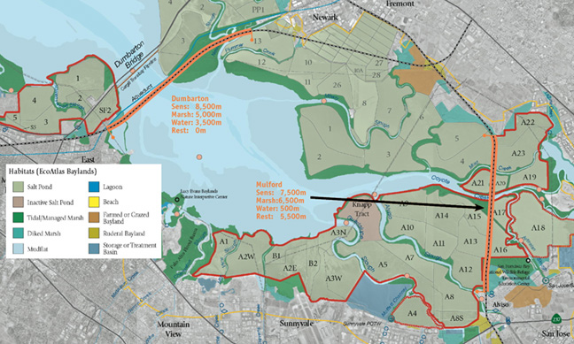 The map shows the different ecologies of the area, and the salt ponds that have been purchased and are planned for restoration (outlined in red). Orange highlighting has been added to show roughly where the alignments traverse sensitive wetlands. The salt ponds not outlined in red are planned to remain property of the Cargill company and remain in production. Go to www.southbayrestoration.org for more detail on the South Bay Restoration Project. The Dumbarton line would run across the salt pond planned to remain in production, and some alteration of those ponds would be part of the construction of the line. The line would run along an existing powerline corridor, as shown in the photos below. 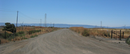 View from end of Perrin Avenue in Newark to powerline / Dumabrton HSR corridor 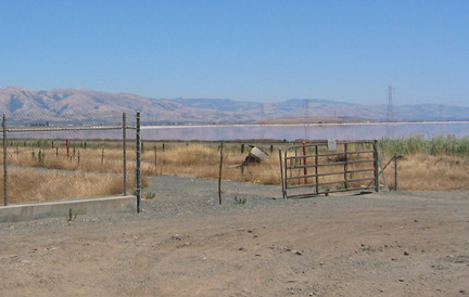 View from end of Willow Street in Newark to powerline / Dumabrton HSR corridor Despite the alarm that the Authority is sounding over the environmental consequences of a Dumbarton alignment along the existing rail line, it is the Mulford line, where the Authority has to fill or build a trestle for a new 2-track railway next to the existing freight line, that runs right through the property purchased for wetlands restoration. More to come....... |

![]()