

Vanished Embarcadero
Since at least the 1920's, planners dreamed of an elevated highway along San Francisco's northeastern waterfront. Just as in New York City, where the Westside Elevated Highway was built above the truck and train congested dockside streets, San Francisco's planners saw the wide, but crowded, wharfside roadway as the perfect location for an elevated motorway.
The Regional Plan Association first suggested an elevated highway in 1926, along with an elevated aviation platform, for the Embarcadero. The plan was never implemented, but would have been very similar to the Westside Highway in New York.
It wasn't until the freeway boom of the 1950's that the elevated highway, now a fist link in a network of interstate freeways circling the City, would come to the foot of Market Street.

The Embarcadero Freeway, Interstate 480, was to run from the Bay Bridge to the Golden Gate Bridge. It only made it to Broadway, but that was enough to mar the east end of downtown for 30 years.
But the construction of the Embarcadero Freeway sparked rebellion against other freeways planned for San Francisco, and the experience gained in San Francisco's freeway fights was shared to fight freways across the nation and around the globe.
Just in San Francisco, imagine the Panhandle of Golden Gate Park as nothing more than a lavishly landscaped sunken freeway. How about a freeway offshore of the Marina Green? Maybe a gash across the north end of North Beach for 8 lanes of freeway? Or a few block of the Inner Sunset gone for a freeway interchange? Stately homes along Tunnel Road and Ashby Avenue in Berkeley replaced by a freeway? Or a toll plaza on Angel Island for a SF - Tiburon bridge?
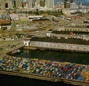
Amazing today, but not years ago. There was a time when the waterfront was not a place the public really went, much like many of today's industrial parks. The trucks and trains were in constant motion, and most of the building were warehouses.
Just look at South Beach in 1975. Today it is highrise apartments, a marina, and lofts. In this photo, taken above the current marina, you can see BOXCARS on a siding, weed-covered lots, and rows of piers. The brick warehouse in the upper-middle of the shot is the Oriental Warehouse, and the Steamboat Point apartments now stand where the boxcars are.

How about this shot, again from around 1975? The (then) new (relocated) Southern Pacific (Caltrain) station is in the middle of the shot. Behind it still stood the old SP station, in all its mission-style glory. It was demolished because the highway engineers determined it would be more cost-efficent to move the station than to build another high off-ramp (ala Sixth Street) across the tracks to serve Fourth Street traffic to I-280. Well, the ramp was never built, but the old train station was destroyed.
The last section of Interstate freeway to be built in San Francisco was this tail of I-280. Today, it is all gone, replaced bu the ramps that flow into King Street. PacBell Park, home of the Giants, sits on the blocks at the end of the freeway. Today (Fall 2001), residential highrises are being built where the freeway was, and on the site of the old train station. (The old train station was an RV park for 20 years, and then a parking lot while plans for its redevelopment were being finalized.

Even the foot of Market Street, at the edge of the Financial District, was forlorn in the 70's. This shot shows the utilitarian BART pier behind the Ferry Building before the construction of the Golden Gate Ferry terminal and Gabbiano's restaurant. The derilict piers south of the Ferry Building were not yet removed for the promenade, and Embarcadero Center only had two highrises.